Huracanes, Olas de Calor, Tormentas y Desinformación
Bienvenidos a Meteorology Matters en Español, el podcast que explica la ciencia del tiempo y los fenómenos extremos que están cambiando nuestro mundo. Desde olas de calor históricas hasta huracanes que se intensifican rápidamente, aquí encontrarás explicaciones claras, entrevistas con expertos y análisis de cómo estos eventos afectan a nuestras comunidades. Publicado semanalmente, este espacio busca combatir la desinformación y compartir los hechos más importantes sobre la meteorología y sus impactos.En este episodio de Meteorology Matters, analizamos lo último sobre olas de calor extremas, huracanes y patrones cambiantes como La Niña. Exploramos investigaciones innovadoras que vinculan a las compañías de combustibles fósiles con el empeoramiento de las olas de calor, los riesgos de tormentas que se intensifican rápidamente y las batallas políticas que transforman agencias como el DOE y el CDC. Con la desinformación propagándose más rápido que nunca, este resumen aclara la confusión y ofrece los hechos más importantes a finales de 2025. Comienza "Meteorology Matters" serie de podcasts ahora mismo con el episodio 1 de la temporada 101, solo para darle una oportunidad. Cuéntenme qué les parece y si les gustaría que esto continúe, posiblemente convirtiéndose en su propio canal. Dale like, inscríbate, comenta y sigue en redes sociales… Instagram @meteorologistTikTok @TVmeteorologistYouTube @RobJonesHurricane
12 Syys 19min

Hurricane Season Stalls as Ocean Waters Heat Up
In this episode of Meteorology Matters, we break down the latest hurricane season update, science behind extreme weather, from record-breaking heatwaves to rapidly intensifying hurricanes, and explore how shifting ocean patterns like La Niña may shape the months ahead. We also examine the growing battles over science, misinformation, and public trust. Stay informed with the facts that matter most in 2025.
12 Syys 35min
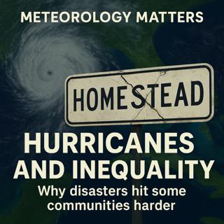
Hurricanes and Inequality: Racism in the Recovery
Hurricanes don’t just destroy buildings, they reshape communities. In this episode of Meteorology Matters, Rob Jones dives into how storms like Andrew, Katrina, and Ian left behind more than physical damage. From South Florida’s racial and ethnic divides, to gentrification in New Orleans, to today’s booming coastal housing markets, we explore how disasters deepen inequality. Who bounces back and who gets left behind?Keywords Hurricane Andrew, Hurricane Katrina, Hurricane Ian, disaster inequality, Florida hurricanes, climate change, housing markets, gentrification, natural disasters, Miami history, racial inequality, hurricane recovery, insurance crisis
1 Syys 42min

Disaster Capitalism in New Orleans: Whitewashed Urban Transformation after Hurricane Katrina
In this episode of Meteorology Matters, we dive into how Hurricane Katrina reshaped New Orleans, not just physically, but politically and economically. We uncover how “disaster capitalism” and neoliberal urban policies turned the city into a laboratory for privatization, gentrification, and displacement. From skyrocketing rents and the demolition of public housing to the cultural erasure of long-time Black residents, New Orleans became a model for how crises can accelerate inequality in American cities.🔑 Keywords: Hurricane Katrina, New Orleans recovery, neoliberal urban policy, disaster capitalism, housing crisis, gentrification, inequality, post-Katrina, public housing, urban planning, disaster recovery, racial inequality.
30 Elo 48min
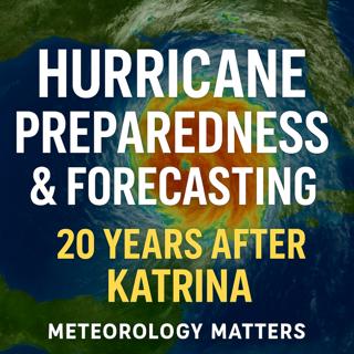
Hurricane Preparedness & Forecasting 20 Years After Katrina
🌪️ Hurricane Preparedness & Forecasting 20 Years After KatrinaEpisode Description:It’s been 20 years since Hurricane Katrina reshaped the Gulf Coast — and the way we forecast and prepare for hurricanes. In this episode of Meteorology Matters, Rob Jones breaks down how forecasting has improved, where the biggest vulnerabilities remain, and why climate change is making storms more dangerous.You’ll discover:How new satellites and models have cut hurricane track errors by 50% since KatrinaWhy storm surge — not wind — remains the deadliest hurricane threatThe hidden risks in New Orleans’ levee system, still only rated for a Category 3 stormHow rapidly intensifying storms are reducing evacuation timeWhy budget cuts to FEMA and NOAA could stall future forecasting progressWhether you live on the Gulf Coast, the East Coast, or inland, these insights could help you understand the real risks of hurricanes in a warming world — and why preparation matters more than ever.👉 Listen now on Apple Podcasts, Spotify, YouTube, or your favorite app. Don’t forget to follow, rate, and share to help others stay weather-ready.
29 Elo 28min

The Enduring Lessons of Hurricane Katrina and the Current State of U.S. Disaster Preparedness
The Enduring Lessons of Hurricane Katrina and the Current State of U.S. Disaster PreparednessDate: August 25, 2025Twenty years after Hurricane Katrina, its lessons remain profoundly relevant, highlighting systemic failures in national preparedness, coordination, and the critical role of federal agencies. While significant strides have been made in hurricane science and forecasting since 2005, particularly through federally funded initiatives, these gains and the overall U.S. disaster response capability are now critically at risk. Current administrative actions, including budget cuts, leadership inexperience, and a proposed reduction in FEMA's role, threaten to roll back two decades of progress, leaving the nation more vulnerable to increasingly intense and frequent climate-driven disasters. Experts and FEMA staff alike warn that the country is regressing to a "pre-Katrina era" of unpreparedness, with potentially catastrophic consequences.I. Hurricane Katrina: A Catalog of Systemic Failures (2005 Perspective)Hurricane Katrina, making landfall on August 29, 2005, as a Category 3 hurricane near the Louisiana-Mississippi border, was "an extraordinarily powerful and deadly hurricane that carved a wide swath of catastrophic damage and inflicted large loss of life." It became "the costliest and one of the five deadliest hurricanes to ever strike the United States," with a revised death toll of nearly 1,400 and an inflation-adjusted damage estimate of $186.3 billion (NHC, NPR). The federal response was "widely seen as a failure" (Yale Climate Connections), exposing deep-seated flaws across multiple domains.A. Core Failures Identified in "Katrina - Lessons Learned" Report:The Bush administration's "Lessons Learned" report identified 17 critical challenges, underscoring the inadequacy of the existing system for catastrophic threats. B. The Vulnerability of New Orleans:New Orleans was uniquely vulnerable due to its geography (half the city at or below sea level), loss of protective wetlands, and an inadequate levee system that "many scientists thought were too low" (NPR). A 2004 disaster simulation, "Hurricane Pam," predicted "thousands of deaths and that the entire city would be flooded," but federal agencies did not grasp the seriousness (NPR). The catastrophic levee failures, rather than just the storm's intensity, were the primary cause of devastation, overwhelming even more robust defenses in some areas due to "water levels over 27 feet" (Georgia Tech).C. Social and Economic Inequalities:Katrina "exposed and deepened existing social and economic inequalities." Lower-income Black neighborhoods, due to "years of segregation, disinvestment, and discriminatory housing policies," were "uniquely vulnerable" with residents often lacking "access to reliable transportation, making evacuation difficult or impossible." (Georgia Tech)II. Progress Since Katrina: Hurricane Science and ForecastingIn the two decades since Katrina, "hurricane scientists have made great strides toward understanding how climate change influences tropical cyclones, at the same time as they have vastly improved hurricane forecasting" (OPB).III. Current State of Vulnerability: Backsliding Towards a "Pre-Katrina Era" (2025 Perspective)Despite the scientific progress, disaster experts and FEMA staff warn that the U.S. is facing a severe regression in its disaster preparedness and response capabilities, reminiscent of the conditions that exacerbated the Katrina disaster.
25 Elo 31min

Alligator Alcatraz (Auschwitz) Concentration Camp Environmental Issues and Everglades Jetport History
A federal judge in Miami has ordered the state of Florida to dismantle the "Alligator Alcatraz" immigrant detention facility in the Florida Everglades within 60 days, citing severe and irreparable environmental harm. This ruling, a significant victory for environmentalists and the Miccosukee Tribe of Indians, prohibits further expansion and mandates the removal of specific infrastructure. The facility, built on the site of a thwarted 1960s jetport, was fast-tracked without required environmental assessments, leading to habitat loss, increased mortality for endangered species, and disruption to a federally protected ecosystem. Florida Governor Ron DeSantis and the Trump administration have vowed to appeal the decision, maintaining the facility's minimal environmental impact. The ruling highlights a recurring conflict between development and environmental preservation in the Big Cypress region, emphasizing the importance of environmental laws like NEPA, CWA, and ESA.Order to Dismantle: U.S. District Judge Kathleen Williams has ordered Florida to clear out the "Alligator Alcatraz" facility within 60 days. This includes the removal of fencing, lighting, generators, and waste receptacles.Irreparable Harm: Judge Williams cited expert testimony that the project "creates irreparable harm in the form of habitat loss and increased mortality to endangered species in the area" (Washington Post).Lack of Environmental Assessment: A key finding was that an environmental assessment was required before the site was erected, but "the Defendants chose not to do so." Williams stated there was "no process" for evaluating environmental risks (Washington Post, Axios Miami).Protected Species Threatened: The facility is located on federally protected land critical for several endangered species, including:Florida panther (Puma concolor coryi): The project is in the Primary Zone of the Panther Focus Area, with four known panther dens within 12 km. New lighting alone has reduced panther habitat by 2,000 acres (Washington Post, The Wildlife Society, Axios Miami).Everglade snail kite, wood storks (Washington Post).Habitat Destruction and Fragmentation:Paving over at least 20 adjacent acres of wetlands (Washington Post).Installation of approximately 28,000 feet of barbed wire fencing, which "fragments habitats and acts as barriers to wildlife movement" (The Wildlife Society).Light Pollution: The site is a designated International Dark Sky Park, but industrial, stadium-style lights are on 24/7, visible from over 15 miles away, disrupting nocturnal species (The Wildlife Society, Washington Post).Water Contamination and Pollution:Concerns about runoff and wastewater discharge harming the Everglades (Axios Miami).Drinking and bathing water is trucked in, and sewage, trash, and wastewater trucked out (Washington Post).3. Location and Historical ContextBig Cypress National Preserve: The facility is located deep within Big Cypress National Preserve, near the border with Everglades National Park (Washington Post, The Wildlife Society, Sierra Club).Dade-Collier Training and Transition Airport (TNT): The detention center repurposes an old airstrip, which was originally part of a 1960s plan for the "world's largest airport" – the Miami Jetport (Washington Post, Axios Miami, The Wildlife Society).
23 Elo 21min

Erin: Big Hurricane, Big Waves, Big Rip Current Risk
Date: August 21, 2025Current Status and Impacts of Hurricane Erin with Climate Context and Future OutlookHurricane Erin, a massive and dangerous Category 2 storm, is currently making its closest approach to the U.S. East Coast after 10 days of churning across the Atlantic. While its trajectory keeps the center offshore, its immense size (a "sprawling 1,000 miles wide," with a tropical-storm-force wind field extending 325 miles from its center) is causing widespread and significant coastal impacts from Florida to Newfoundland, Canada, and will affect Western Europe as a post-tropical cyclone. The storm's rapid intensification from Category 1 to Category 5 within 24 hours (an increase of nearly 85 mph) is highlighted as a direct consequence of human-caused climate change, linking warmer ocean temperatures to increased storm intensity and potential damage. Evacuation orders are in place for parts of North Carolina's Outer Banks, and 15 U.S. states are under various hazardous coastal alerts. Beyond Erin, a quiet period for tropical development is anticipated for the next 10-14 days in the Atlantic, though the latter half of September may see above-average activity.I. Current Status and Forecast of Hurricane ErinClosest Approach and Movement: Erin has made its "closest approach to the North Carolina coast" and is now moving north-northeastward at 15 kt. It is expected to "continue to accelerate and turn east-northeastward by Friday as it becomes increasingly embedded within the mid-latitude westerlies," eventually reaching a peak forward speed of about 35 kt in 72 hours.Life-Threatening Surf and Rip Currents: This is a "Key Message" from the NHC, stating Erin "will continue to produce life-threatening surf and rip currents along the beaches of the Bahamas, much of the east coast of the U.S., Bermuda, and Atlantic Canada during the next several days." Beachgoers are cautioned against swimming, and many East Coast beaches will be closed to swimmers through Friday.Coastal Flooding and Erosion:North Carolina Outer Banks: "Storm surge flooding and tropical storm conditions will continue." The surge, accompanied by large waves, will lead to "significant beach erosion and overwash, making some roads impassable." Evacuation orders remain for Hatteras and Ocracoke islands. Up to 4 feet of storm surge and waves up to 20 feet are expected.Virginia and Maryland: "Moderate to major coastal flooding is expected," particularly during high tides on Thursday evening, with potential for "numerous road closures and the inundation of homes and businesses near the shore." Waves of 10-14 feet are anticipated.Chesapeake Bay Area: "Higher than normal water levels of up to 3 feet may inundate areas along the shores of the lower Chesapeake Bay, with up to a half foot of flooding along the tidal Potomac River."Delaware and New Jersey: 1 to 2 feet of water may inundate coastal and bayside communities, making roads impassable. "Dangerous surf will slam the coastline."New York and New England: High-surf advisories and coastal flood warnings are in effect.
21 Elo 33min