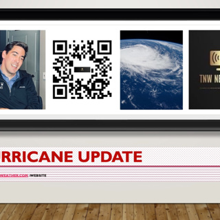
.DISTURBANCE MOVING A LITTLE FASTER TOWARD THE NORTHEAST... Northwestern Bahamas: 3 to 6 inches with maximum of 10 inches. This rain may produce flash and urban flooding. At 400 PM CDT (2100 UTC), the

.DISTURBANCE MOVING A LITTLE FASTER TOWARD THE NORTHEAST... Northwestern Bahamas: 3 to 6 inches with maximum of 10 inches. This rain may produce flash and urban flooding. At 400 PM CDT (2100 UTC), the

.DISTURBANCE MOVING A LITTLE FASTER TOWARD THE NORTHEAST...

Northwestern Bahamas: 3 to 6 inches with maximum of 10 inches. This rain may produce flash and urban flooding.

At 400 PM CDT (2100 UTC), the disturbance was about 350 miles (560 km) southwest of Ft. Myers, Florida. The system is moving toward the northeast near 7 mph (11 km/h), and a northeastward motion with an increase in forward speed is expected during the next couple of days. On the forecast track, the system should move across the southeastern Gulf of Mexico tonight, across the southern and central portions of the Florida Peninsula on Saturday, and then over the southwestern Atlantic north of the northwestern Bahamas late Saturday through Sunday. Maximum sustained winds are near 40 mph (65 km/h) with higher gusts. The system is expected to develop a well-defined center and become a tropical storm tonight, and some slight strengthening is possible while it approaches Florida. Additional strengthening is possible after the system moves east of Florida over the western Atlantic Saturday night and Sunday. It has a high (90 percent) chance of formation during the next 48 hours and during the next five days.

RAINFALL: The potential tropical cyclone will continue to produce heavy rains across western Cuba through today. Heavy rain will begin to affect Central Florida, South Florida and the Keys today through Saturday, and affect northwestern Bahamas tonight through Saturday. The following storm total rainfall amounts are expected:

Western Cuba: 6 to 10 inches, with isolated maxima of 14 inches. This rain may cause life-threatening flash flooding and mudslides.

Central Florida, South Florida, and the Florida Keys: 4 to 8 inches with maxima of 12 inches across South Florida and in the Keys This rain may produce considerable flash and urban flooding.

Northwestern Bahamas: 3 to 6 inches with maxima of 10 inches. This rain may produce flash and urban flooding.

WIND: Tropical storm conditions are expected in the warning area in Cuba through tonight, in Florida tonight and on Saturday, and in the northwestern Bahamas on Saturday. Tropical storm conditions are possible in the watch area in Cuba this afternoon and tonight.

STORM SURGE: The combination of storm surge and the tide will cause normally dry areas near the coast to be flooded by rising waters moving inland from the shoreline. The water could reach the following heights above ground somewhere in the indicated areas if the peak surge occurs at the time of high tide...

Marco Island, FL to Card Sound Bridge...1-3 ft

Middle of Longboat Key, FL to Marco Island, FL...1-2 ft

Charlotte Harbor...1-2 ft

Florida Keys and Dry Tortugas...1-2 ft

Card Sound Bridge to North Miami Beach, FL including Biscayne Bay...1-2 ft

Extreme Northwestern Bahamas: storm surge could raise water levels by as much 1- 3 ft above normal tide levels. Surge-related flooding depends on the relative timing of the surge and the tidal cycle and can vary greatly over short distances. For information specific to your area, please see products issued by your local National Weather Service forecast office.

TORNADOES: A few tornadoes are possible over the southern Florida Peninsula and the Florida Keys tonight and Saturday.

Next complete advisory at 1000 PM CDT.

Denne episoden er hentet fra en åpen RSS-feed og er ikke publisert av Podme. Den kan derfor inneholde annonser.

Episoder(29)

Atlantic tropical development on the horizon next week

Atlantic tropical development on the horizon next week

Atlantic tropical development on the horizon next week

16 Jun 20232min

AIR FORCE HURRICANE HUNTERS INDICATE DEPRESSION HAS STRENGTHENED INTO TROPICAL STORM ARLENE... At 100 PM CDT (1800 UTC), the center of Tropical Storm Arlene was located about 340 miles NNW of the west

AIR FORCE HURRICANE HUNTERS INDICATE DEPRESSION HAS STRENGTHENED INTO TROPICAL STORM ARLENE... At 100 PM CDT (1800 UTC), the center of Tropical Storm Arlene was located about 340 miles NNW of the west

AIR FORCE HURRICANE HUNTERS INDICATE DEPRESSION HAS STRENGTHENEDINTO TROPICAL STORM ARLENE...At 100 PM CDT (1800 UTC), the center of Tropical Storm Arlene was located about 340 miles NNW of the wester...

2 Jun 20234min

Update on the area of low pressure over the northeastern Gulf of Mexico: Recent satellite wind data, along with buoy and ship observations indicate the area of low pressure over the northeastern Gulf

Update on the area of low pressure over the northeastern Gulf of Mexico: Recent satellite wind data, along with buoy and ship observations indicate the area of low pressure over the northeastern Gulf

Update on the area of low pressure over the northeastern Gulf of Mexico:Recent satellite wind data, along with buoy and ship observations indicate the area of low pressure over the northeastern Gulf o...

1 Jun 20233min

oday, in the Northeastern Gulf of Mexico, showers and thunderstorms associated with an area of low pressure over the northeastern Gulf of Mexico have increased and become better organized during the o

oday, in the Northeastern Gulf of Mexico, showers and thunderstorms associated with an area of low pressure over the northeastern Gulf of Mexico have increased and become better organized during the o

oday, in the Northeastern Gulf of Mexico, showers and thunderstorms associated with an area of low pressure over the northeastern Gulf of Mexico have increased and become better organized during the o...

1 Jun 20231min

Trevor Force season 2 of the hurricane update

Trevor Force season 2 of the hurricane update

Promo Force season of the Hurricane update,show update will officially start on June 1 2023 every hour for active Hurricane development. Every day from now on curve Hurricane development between 8 A...

24 Mai 202355s

..DANIELLE BECOMES THE FIRST ATLANTIC HURRICANE OF THE SEASON...

..DANIELLE BECOMES THE FIRST ATLANTIC HURRICANE OF THE SEASON...

..DANIELLE BECOMES THE FIRST ATLANTIC HURRICANE OF THE SEASON... At 300 PM GMT (1500 UTC), the center of Hurricane Danielle was about 885 miles (1425 km) west of the Azores (near latitude 37.9 North, ...

2 Sep 20223min

Showers and thunderstorms associated with an area of low pressure located about 300 miles south of the southern end of the Baja California Peninsula has become a little better organized overnight. Env

Showers and thunderstorms associated with an area of low pressure located about 300 miles south of the southern end of the Baja California Peninsula has become a little better organized overnight. Env

To the Eastern North Pacific: Showers and thunderstorms associated with an area of low pressure located about 300 miles south of the southern end of the Baja California Peninsula has become a little b...

1 Sep 20223min

 Hurricane DARBY RAPIDLY INTENSIFIES...

Hurricane DARBY RAPIDLY INTENSIFIES...

.DARBY RAPIDLY INTENSIFIES... At 1200 AM HST (1000 UTC), the center of Hurricane Darby was located near latitude 14.5 North, and longitude 122.2 West. Darby is moving toward the west near 16 mph (26 k...

11 Jul 20223min

Populært innen Politikk og nyheter

giver-og-gjengen-vg
aftenpodden
bt-dokumentar-2
popradet
aftenpodden-usa
forklart
stopp-verden
det-store-bildet
fotballpodden-2
nokon-ma-ga
dine-penger-pengeradet
rss-espen-lee-usensurert
rss-gukild-johaug
hanna-de-heldige
rss-ness
aftenbla-bla
rss-penger-polser-og-politikk
frokostshowet-pa-p5
e24-podden
saken