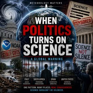
When Politics Turns on Science Globally
Weather scientists are increasingly being ignored, censored, arrested, or pushed aside by political movements around the world. From NOAA staffing cuts in the United States to jailed earthquake scient...
15 Maj 45min

2026 Weather Shock: Super El Niño, Record Heat, and a Planet Running Hot
A Super El Niño may be forming for 2026, and it could push global heat, extreme weather, flooding, drought, and hurricane impacts into dangerous new territory.A Super El Niño may be forming for 2026, ...
8 Maj 33min

AI Weather Forecasts Are Getting Smarter. So Why Are We Weakening NOAA?
AI is revolutionizing weather forecasting. New models like Google DeepMind’s GraphCast and GenCast, ECMWF’s AIFS, and NOAA’s experimental AI-GEFS are producing faster, cheaper, and increasingly accura...
5 Maj 42min

AI Just Beat Hurricane Forecasting… Should We Be Worried?
AI just changed hurricane forecasting forever. In 2025, it outperformed traditional models and even challenged official NHC forecasts. Artificial Intelligence is no longer experimental in meteorology ...
21 Apr 53min

Will Hurricane Forecasts Get Worse? Inside the NOAA Budget Cuts
Could hurricane forecasts actually get worse? A deep dive into the proposed 2027 budget cuts to NOAA and how eliminating key research could impact storm prediction, safety, and future forecast accurac...
13 Apr 32min

Fired, Sued, and Still Forecasting: The Matt Devitt vs WINK News Battle
Fired. Sued. And still forecasting.The sudden termination of longtime Southwest Florida meteorologist Matt Devitt has exploded into one of the most fascinating media and legal battles in recent years....
4 Apr 37min
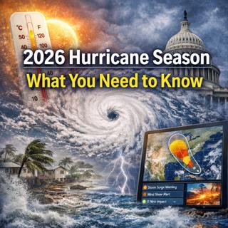
“It Only Takes One”: Why 2026’s Hurricane Season Could Be Worse Than It Looks
The 2026 hurricane season warning nobody is talking about. The numbers may be average but the risk is anything but because “It only takes one”.The 2026 Atlantic hurricane season may look average on pa...
28 Mars 40min
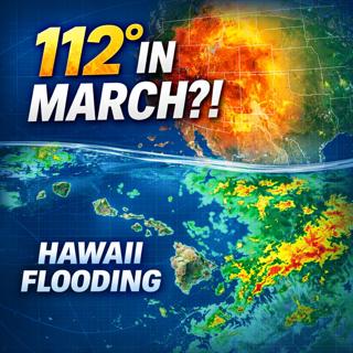
This Should NOT Be Happening in March… 112° Heat + Hawaii Flood Disaster
In this episode of Meteorology Matters, we break down two extreme and highly unusual weather events happening right now:🔥 Record-shattering March heat reaching 112°F🌊 Dangerous flooding impacting pa...
21 Mars 38min