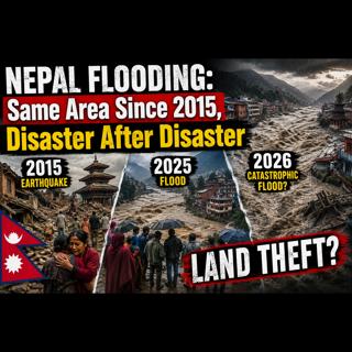

NEPAL Flooding: Same Land. Same People. Since 2015, Disaster After Disaster - LAND THEFT on STEROIDS

NEPAL Flooding: Same Land. Same People. Since 2015, Disaster After Disaster - LAND THEFT on STEROIDS

When the people can no longer live on the land, the question becomes: who gets it?

Nepal has endured a remarkable sequence of disasters involving earthquakes, floods, landslides, dams, hydropower projects and repeated displacement of mountain communities. The devastating 2015 Nepal earthquake destroyed homes and villages across the country, and years later some families were still struggling with permanent resettlement. Then came new flooding, including destructive events in 2025 and another major disaster in 2026. When the same vulnerable regions appear repeatedly in a disaster timeline, the obvious question is: what is happening to the land and the people who live there?

This episode follows what I call the spider web. Instead of looking at a flood as an isolated event, I follow the rivers, dams, tributaries, hydropower projects and upstream infrastructure. A massive dam such as China's Three Gorges Dam may attract attention first, but following the Yangtze River reveals an enormous network of additional dams and water-control projects. Nepal presents its own complicated web of rivers, dams, proposed hydropower projects, glacial lakes, landslides and downstream communities.

The investigation examines the 2015 Nepal earthquake, displacement and reconstruction, followed by flooding and evacuations in 2025 and 2026. Who was displaced? Were communities completely rebuilt before the next disaster arrived? Where were the dams and hydropower projects in relation to the flooded areas? What happened upstream before the water reached the villages? And when people repeatedly lose their homes, what ultimately happens to their land?

Nepal is also part of a much larger Himalayan water system involving China, Tibet, India and Bangladesh. Rivers do not recognize national borders. Decisions involving dams, reservoirs, hydropower construction and water releases upstream can therefore become international issues downstream. At the same time, extreme rainfall, glacial lake outburst floods, earthquakes and landslides make the Himalayas naturally hazardous. Separating those natural forces from the possible effects of human infrastructure requires following the entire watershed rather than stopping at the scene of the flood.

This is not simply a story about one flood or one dam. It is a timeline of earthquakes, repeated flooding, dams, hydropower development, displaced families, reconstruction and land. When disaster strikes the same communities again and again, it is worth putting the events side by side and asking questions that disappear when each disaster is reported as an isolated news story.

Music: Creedence Clearwater Revival - Bad Moon Rising (Official Lyric Video)

2026 Nepal floods - Wikipedia

Do you have a psychopath in your life? The best way to find out is read my book. BOOK *FREE* Download – Psychopath In Your Life4

How they flip sex with hormones: Hormones

Support is Appreciated: Support the Show – Psychopath In Your Life Tune in: Podcast Links – Psychopath In Your Life

Download Pods here - one click and pods load to any device fully titled and ready to listen to or archive: TOP PODS – Psychopath In Your Life

My old discussion forum with last 10 years of victim stories, is back online. Psychopath Victim Support Community | Forums powered by UBB.threads™

Google Maps My HOME Address: 309 E. Klug Avenue, Norfolk, NE 68701 SMART Meters & Timelines – Psychopath In Your Life

The flooding in Nepal in August 2026 was triggered by a glacial collapse. A section of a glacier and mountain debris collapsed on the north side of Lāngtāng Lirung, creating a powerful surge of water and debris that caused widespread flooding. As of August 30, 2026, the situation is as follows:
  • Casualties: At least 362 people have been confirmed killed, and the death toll is expected to rise. 3
  • Missing: More than 1,500 people, including at least 800 foreigners, are still missing. 5
  • Damage: The flood destroyed roads, snapped bridges, toppled buildings, and cut off communications, leaving a 40-mile-long path of destruction. At least 20 schools were damaged, and six major hydropower and transmission facilities were damaged. 34
  • Rescue efforts: Nepalese soldiers and rescue teams, as well as international organizations, are working to save the missing and provide assistance to the affected population.
Nepal: They Knew the Risk. They Had a Warning. So What Happened?

Three months before a wall of water, mud and rock tore through a Himalayan valley along the Nepal-China border, killing hundreds, experts and government officials from Nepal and China were sitting together in Kathmandu discussing the risk of exactly these kinds of disasters.

But this story didn't begin in 2026.

Some people displaced by the 2015 disaster were reportedly still living in vulnerable temporary settlements when another major flood struck the region in 2025. Then, in August 2026, the river system was devastated again.

And there was a warning.

China sent Nepal an alert 12 days before the catastrophe warning of heavy rainfall and the possibility of landslides and flash floods.

So before we simply label this another Himalayan natural disaster, I want to follow the entire system.

The dams. The rivers. The nuclear facilities. The hydropower projects. The trade routes. The displaced communities. The warnings. And the timeline of what actually happened.

During major flooding, reservoirs can fill rapidly, and dam operators may have to release water downstream. I have not established that water was released from dams in this area during this disaster, but that is one of the questions worth investigating.

We also have what authorities are describing as a natural dam—debris from falling ice and rock blocking the river and creating a lake behind it.

But that raises another question.

If that natural dam had already been sitting there for roughly 18 or 19 hours, what exactly produced the enormous seismic signal recorded at 8:37 the following morning?

Early reports described an earthquake in the area. Later explanations focused on collapsing ice and rock, the debris dam, the lake that formed behind it and its eventual failure.

And now another explanation is moving to the forefront: climate change.

Rising temperatures, melting glaciers and thawing permafrost are being cited as factors increasing the danger of catastrophic floods in the Himalayas.

Maybe those factors are part of the story.

We've Heard Questions Like This Before

After Hurricane Katrina in 2005, residents of the Lower Ninth Ward and nearby communities reported hearing loud explosions around the time the levees failed. Some residents alleged that the Industrial Canal levee had been deliberately blown to divert water away from more valuable parts of New Orleans.

Those allegations became prominent enough that they were discussed publicly and even entered the congressional record. A House report noted receiving numerous reports from people who said they heard what sounded like explosions or bombs.

The major engineering investigations, however, did not find evidence that explosives caused Katrina's levee breaches. Investigators attributed the failures to engineering and structural problems, overtopping, erosion and foundation failures. There were also serious allegations concerning defective construction and possible corruption surrounding some floodwall work.

But here's the historical piece that makes the Katrina suspicions particularly understandable:

New Orleans authorities really had dynamited a levee before. During the Great Mississippi Flood of 1927, political and business leaders deliberately blew the levee south of New Orleans.

The objective was to relieve pressure and protect New Orleans and its commercial interests.

The result was flooding in St. Bernard and Plaquemines parishes.

PBS's history of the event records that it ultimately took 39 tons of dynamite to open the levee sufficiently. Residents were displaced, and the compensation they had been promised proved grossly inadequate.

There was another episode during Hurricane Betsy in 1965. A congressional Katrina report states that the Florida Avenue levee was initially breached by the storm, but that the Corps subsequently intentionally breached some levee points as part of drainage management.

So there's an important distinction:

1927 — deliberate dynamiting is historical fact.

1965 — intentional breaching after the storm breach is documented in the congressional Katrina report.

2005 Katrina — deliberate dynamiting was alleged by residents, but subsequent investigations did not establish explosives as the cause of the levee failures.

And that history connects directly to what I'm examining in Nepal in one useful respect.

Deliberately altering a levee or releasing water to protect a more valuable asset is not some imaginary concept—it has happened historically.

There's also an interesting social-history paper specifically about the Katrina dynamiting allegations. Historian Ari Kelman argues that they can't really be understood without the 1927 history, when powerful interests actually did sacrifice downstream communities to protect New Orleans.

The Spider Web

Nepal has endured a remarkable sequence of disasters involving earthquakes, floods, landslides, dams, hydropower projects and repeated displacement of mountain communities.

The devastating 2015 Nepal earthquake destroyed homes and villages across the country, and years later some families were still struggling with permanent resettlement.

Then came new flooding, including destructive events in 2025 and another major disaster in 2026.

When the same vulnerable regions appear repeatedly in a disaster timeline, the obvious question is:

What is happening to the land and the people who live there?

This episode follows what I call the spider web.

Instead of looking at a flood as an isolated event, I follow the rivers, dams, tributaries, hydropower projects and upstream infrastructure.

A massive dam such as China's Three Gorges Dam may attract attention first, but following the Yangtze River reveals an enormous network of additional dams and water-control projects.

Nepal presents its own complicated web of rivers, dams, proposed hydropower projects, glacial lakes, landslides and downstream communities.

The investigation examines the 2015 Nepal earthquake, displacement and reconstruction, followed by flooding and evacuations in 2025 and 2026.

  • Who was displaced?
  • Were communities completely rebuilt before the next disaster arrived?
  • Where were the dams and hydropower projects in relation to the flooded areas?
  • What happened upstream before the water reached the villages?

And when people repeatedly lose their homes, what ultimately happens to their land?

Nepal is also part of a much larger Himalayan water system involving China, Tibet, India and Bangladesh.

At the same time, extreme rainfall, glacial lake outburst floods, earthquakes and landslides make the Himalayas naturally hazardous.

In order to figure out whether dams could be contributing to flooding, I think of the river system like a spider web.

I found the river.

I followed the water.

And then I started finding the dams and hydropower projects.

And that's when this story got very interesting.

I looked for the hydropower plants, the water, and then, at the root, the blockage.

Dams typically get built where poor people live, then the poor people can't move far away, so they end up settling next to dams.

And there is another issue here.

People are complaining: Why wasn't this problem fixed after the event in 2025?

WHAT HAPPENED TO THE WATER? What Happened in 2026?

The flooding in Nepal in August 2026 was triggered by a glacial collapse.

A section of a glacier and mountain debris collapsed on the north side of Lāngtāng Lirung, creating a powerful surge of water and debris that caused widespread flooding.

As of August 30, 2026, the situation is as follows:

Casualties: At least 362 people have been confirmed killed, and the death toll is expected to rise.

Missing: More than 1,500 people, including at least 800 foreigners, are still missing.

Damage: The flood destroyed roads, snapped bridges, toppled buildings and cut off communications, leaving a 40-mile-long path of destruction. At least 20 schools were damaged, and six major hydropower and transmission facilities were damaged.

Rescue efforts: Nepalese soldiers and rescue teams, as well as international organizations, are working to save the missing and provide assistance to the affected population.

But This Same Corridor Was Hit in 2025

This is where the timeline becomes important, because this wasn't the first catastrophic flood in this river corridor.

July 8, 2025 — catastrophic upstream glacial flood hits this corridor.

August 26, 2026 — another, vastly larger catastrophe hits essentially the same corridor.

And after the 2025 event, they unquestionably knew this particular upstream watershed could produce a sudden destructive flood.

In fact, contemporary reporting on the 2026 disaster explicitly points back to the July 8, 2025 flood as the previous similar event.

That's only 414 days apart.

But before following the people and the land, I want to understand exactly what happened upstream on August 25 and 26.

The 8:37 Seismic Event

The first important point is that instruments really did record a very large seismic event at 8:37 a.m. on August 26.

USGS initially automatically classified it as a magnitude 4.4 earthquake.

Nepal's government repeated that information publicly that morning; the foreign minister told Parliament that preliminary information indicated an earthquake at 8:37 had triggered an avalanche.

But after examining the waveform, nearby seismic stations and satellite imagery, USGS reclassified it.

Their current conclusion is explicit:

No earthquake had occurred.

Instead, the collapse of an enormous mass of ice and rock, followed by the debris flow, generated seismic energy equivalent to approximately a magnitude 5.2 earthquake.

So was the ground actually shaking?

Yes.

Nepal Flood Timeline: What Happened Before 8:37? August 25, 2026 — Approximately 1:30–2:30 p.m.

According to the rapid scientific assessment published by the Integrated Research on Disaster Risk organization, a massive failure involving ice, rock and soil occurred in the Deding/Langtang region.

The debris fell into the river system and apparently created a natural dam.

The report estimates that this blockage remained in place for approximately 18 to 19 hours.

That would put the formation of the natural dam sometime during the afternoon of August 25.

Water then began accumulating behind the obstruction.

Importantly, the disappearance or reduction of water downstream may not have been obvious.

Researchers say the Mala River and other tributaries continued feeding water into the river below the blockage.

So downstream, the river could still have appeared to be flowing while farther upstream an enormous amount of water was accumulating behind the debris.

This is the beginning of the timeline that needs much more attention.

Overnight — August 25 into August 26

If the 18–19-hour reconstruction is correct, the natural dam is now sitting across the river.

Water continues accumulating behind it.

The temporary lake grows.

Ice, rock, soil and debris are holding that water back.

What was happening to that obstruction throughout the night is not yet clear.

Was it stable?

Was it slowly eroding?

Was additional material falling from the mountain?

Was the lake rising rapidly?

Were there smaller seismic events?

Were there sounds or ground movement in the area?

And most importantly:

What do the satellite images show during these hours?

Because according to this reconstruction, the dam already exists.

August 26 — Before 8:30 a.m.

The natural dam has now supposedly existed for nearly a day.

Downstream communities apparently have no idea that a large volume of water may be accumulating upstream.

There is no major rainstorm occurring in the Nepalese portion of the watershed that would explain the catastrophe about to arrive.

Everything still appears relatively normal downstream.

Then something happens.

Approximately 8:30–8:37 a.m.

According to the IRDR rapid assessment, this is when the temporary natural dam breaches.

A tremendous volume of water, ice, rock, sediment and debris is suddenly released into the river.

But almost simultaneously, something else is recorded.

8:37:10 a.m. — The Seismic Event

Seismic instruments record an enormous event near the Nepal-Tibet border.

It is powerful enough that it is initially reported as approximately a magnitude 4.4 earthquake.

Nepalese officials consequently begin receiving information that an earthquake may have occurred.

But USGS subsequently reanalyzes the signal.

It concludes that this was not a tectonic earthquake.

Instead, USGS classifies it as a landslide event associated with the glacier and slope failure.

And USGS calculates that the event generated seismic energy equivalent to approximately a magnitude 5.2 earthquake.

That is an enormous physical event.

And this is where the two timelines collide.

Because if the natural dam had already existed for 18 or 19 hours, what exactly happened at 8:37 the following morning that generated an M5.2-equivalent seismic signal?

  • Was there another enormous mountain collapse?
  • Did a much larger portion of the glacier and underlying rock suddenly fall?
  • Did the existing natural dam itself catastrophically collapse?
  • Did the dam failure trigger additional slope failure?
  • Did several of those events happen almost simultaneously?
  • Or is the preliminary estimate that the natural dam existed for 18–19 hours incorrect?

That is the unresolved question.

Approximately 8:40 a.m.

Only minutes after the seismic event, the Rasuwagadhi river monitoring station is still reportedly transmitting.

  • The river measurement is approximately 1.62 metres, below the warning threshold.
  • Then the monitoring station disappears.
  • The flood has arrived.
  • That is exactly the sort of behavior we might expect downstream from a natural dam failure.
  • One moment the river looks relatively normal.
  • Then the wall of water arrives.
About Three Hours Later

But the seismic story isn't finished.

USGS records another seismic event.

  • This one generates energy equivalent to approximately a magnitude 4.2 earthquake.
  • USGS again identifies it as another landslide-type event.
  • So now we have at least two substantial seismic events associated with this disaster.
  • One at 8:37 a.m.
  • Another approximately three hours later.
  • And according to the preliminary IRDR reconstruction, we potentially have an earlier event on August 25 that originally created the natural dam.
  • That gives us a possible sequence of at least three separate stages:

August 25: Something falls into the river and creates the natural dam.

August 26 at 8:37: An enormous M5.2-equivalent mass-movement event occurs at approximately the same time the natural dam reportedly breaches.

Approximately three hours later: Another M4.2-equivalent landslide event occurs.

And that is why I don't think we should treat this simply as:

"A glacier collapsed and caused a flood."

The actual chronology may be considerably more complicated.

THE DAM WAS ALREADY THERE

Everything comes back to one question.

According to the current reconstruction, the natural dam had been blocking the river for 18 to 19 hours.

Water had been accumulating behind it since the previous afternoon.

Then, at 8:37 a.m. on August 26, something enormous happened.

Seismic instruments recorded an event initially identified as an earthquake.

USGS later determined that it was not a tectonic earthquake, but that whatever moved generated seismic energy equivalent to approximately a magnitude 5.2 earthquake.

But if the dam had already been sitting there for 18 or 19 hours—

WHAT HAPPENED AT 8:37 A.M.?

What moved?

What produced that enormous seismic signal?

And why did it happen at approximately the same time the natural dam reportedly failed?

That is the hole in the timeline.

Now Follow the Water Through the Spider Web

For 18 to 19 hours, water had been accumulating behind the natural dam.

Then, around 8:30–8:37 a.m. on August 26, that obstruction gave way.

Now imagine suddenly pulling the plug on an enormous body of water sitting high in a steep Himalayan valley.

The water didn't travel alone.

It carried ice, boulders, rock, mud, sediment, trees and debris with it.

The narrow valley concentrated that mass and sent it racing downstream.

This is where the spider web begins to matter.

  • The water came down the Lhende River and entered the Bhote Koshi.
  • The Bhote Koshi carried it farther downstream toward the Trishuli River.
  • Now the flood was moving through a river corridor containing communities, roads, bridges and a chain of hydropower projects.
  • One part of the system was connected to the next.
  • The flood slammed through Rasuwagadhi, then continued toward Timure and Syabrubesi and farther downstream.
  • Monitoring stations began disappearing.
  • Bridges were washed away.
  • Roads were ripped apart.
  • Hydropower facilities were hit.
  • Powerhouses were damaged.
  • Substations and transmission infrastructure were damaged.

And the water kept going.

The Bhote Koshi feeds the Trishuli, so what began as a natural dam failure high in the mountains was now moving into a much larger river system.

That is the spider web.

It wasn't simply:

Dam breaks. Village floods.

It was:

A huge volume of water accumulates for 18–19 hours.

The obstruction gives way.

That accumulated water enters the Lhende.

The Lhende feeds the Bhote Koshi.

The Bhote Koshi carries it into the Trishuli system.

And all along that interconnected corridor are communities, bridges, roads, hydropower plants, intakes, tunnels, substations and other infrastructure.

The flood ultimately traveled approximately 100 kilometres, according to USGS.

So when that natural dam finally let loose, it didn't release water into an isolated mountain stream.

It released that water into a spider web.

In the specific Bhote Koshi–Trishuli corridor hit by this flood, there were at least 11 operating hydropower projects, plus additional projects under construction.

Nepal's Energy Ministry later counted 27 power projects affected across the Bhote Koshi–Trishuli basins when operating and under-construction projects were included.

So this was a heavily developed hydropower river corridor, not one isolated dam.

Some hydropower plants were flooded or badly damaged, including powerhouses and associated infrastructure.

Other plants survived structurally but were shut down or disconnected as the flood passed.

As the surge traveled down the Bhote Koshi into the Trishuli system, it was passing through a chain of hydropower installations in various states—some surviving, some damaged, some knocked offline.

And that's where the spider web leads me to another part of this story.

The people.

And the land.

PART TWO — WHAT HAD ALREADY HAPPENED TO THE PEOPLE? Nepal: The Same Land, the Same People, and More Than a Decade of Displacement

There is something about this story that doesn't really hit you until you put it on a timeline.

We are looking at the Rasuwa and upper Trishuli River area of Nepal.

Today we're talking about catastrophic flooding.

But these people didn't suddenly become displaced in August 2026.

Some of these communities have been dealing with displacement, land acquisition and major infrastructure development for more than a decade. And remarkably, the hydropower interest in their land begins before the 2015 earthquake. 2009–2010 — They Begin Identifying the Land

The Upper Trishuli-1 hydropower developer began land identification and survey work in 2009 and 2010.

So this is important.

  • Before the earthquake.
  • Before the 2025 flood.
  • Before the catastrophic 2026 flood.

They were already identifying land needed for a major hydropower project in this area.

2012–2013 — Land Acquisition Begins

By 2012, meetings were being held with communities including Haku Besi, Mailung and Gogone.

People were being told where project facilities would be located, how much land would be needed and what compensation would be offered.

Land was measured.

Compensation rates were discussed.

And acquisition proceeded.

The Upper Trishuli-1 project ultimately required approximately 109 hectares of land and affected 154 families.

More than 90 percent of those affected families were Tamang, an Indigenous population of Nepal.

Most of the project's original land acquisition occurred in 2012 and 2013.

So the land story is already underway.

Then everything changes.

April 25, 2015 — The Earthquake

The massive Gorkha earthquake strikes Nepal.

Rasuwa, where Upper Trishuli-1 is located, becomes one of the worst-affected districts.

Within the hydropower project's area of influence alone, project documents say more than 80 percent of the houses were damaged and more than 200 people were killed.

Communities including Haku Besi, Gogone, Tiru and others were devastated.

People lost homes.

People lost agricultural land.

People lost their livelihoods.

Landslides made some areas dangerous or inaccessible.

Residents fled their villages and moved into displacement camps.

And here's where this timeline becomes extraordinary.

The International Finance Corporation later acknowledged that the earthquake had changed the situation so dramatically that it became difficult to separate the effects of the hydropower project's land acquisition from the effects of earthquake displacement.

Many of the people affected by the hydropower project were now scattered among earthquake-displacement camps.

After the Earthquake — They Don't All Go Home

You might assume this was temporary.

  • Earthquake happens.
  • People are evacuated.
  • Homes are rebuilt.
  • People return.
  • But that isn't what happened for everyone.
  • Years passed.
  • Some families remained in temporary settlements.

In 2020, five years after the earthquake, human-rights monitors reported 269 displaced families still living in temporary tin shelters at Khalte Bagar, beside the Trishuli River.

And the problem continued.

Another report documented that of approximately 1,150 families displaced by the earthquake, 174 families still had not obtained land where safe permanent housing could be constructed.

Think about that.

The original disaster happened in 2015.

These people were still dealing with the land and resettlement problem years later.

Meanwhile, Hydropower Development Continues

The earthquake didn't eliminate the strategic importance of the river.

The hydropower development continued.

The project's land requirements didn't disappear.

In fact, additional land was purchased in 2018, including land associated with relocating project infrastructure following the earthquake.

And this wasn't just one hydropower project.

The entire Trishuli River Basin was becoming an enormous hydropower-development corridor.

By 2020, an IFC basin-wide assessment identified more than 36 hydropower projects operating, under development or planned.

If the planned projects were eventually constructed, IFC estimated they would require at least 640 hectares of land.

So while families were still trying to recover from the earthquake, international institutions and developers were continuing to plan the future of this river basin.

July 2025 — The Flood Comes

Now move forward ten years from the earthquake.

A sudden flood comes down the Lhende River at Rasuwagadhi.

  • It destroys the Friendship Bridge.
  • It damages the customs area.
  • It destroys roads.
  • It damages hydropower infrastructure.

People are killed and missing.

Hundreds have to be evacuated.

And sitting beside the Trishuli River are people who were still displaced from the 2015 earthquake.

Human-rights monitors reported that residents of the Khalte Bagar displacement camp stayed awake through the night, terrified that the rising Trishuli would enter their camp.

Think about the irony of that.

They had already been displaced because their original communities were considered dangerous after the earthquake.

Now the place where they had been displaced to was threatened by another disaster.

August 26, 2026 — It Happens Again

Fourteen months later, this river corridor is devastated again.

But this time the destruction is vastly greater.

The accumulated water comes roaring downstream.

  • Once again, it enters the same general river corridor.
  • Once again, communities are destroyed.
  • Once again, people are displaced.
  • Only this time on a catastrophic scale.

2009–2010: Hydropower developers are identifying and surveying land.

2012–2013: Major land acquisition takes place.

2015: The earthquake devastates the project area and displaces many of the same communities. Some residents cannot return safely to their original land and remain in displacement camps.

2018: Additional land is acquired for the hydropower project.

2020: Hundreds of earthquake-displaced families are still reported living in temporary shelters. At the same time, the broader Trishuli basin is documented as having more than 36 hydropower projects operating, under development or planned.

2025: Another report says 174 earthquake-displaced families still lack land for safe permanent housing.

July 2025: A major flood comes down the Lhende and Bhote Koshi into the Trishuli system. People are killed and displaced. Residents still living in an earthquake-displacement camp fear that the flood will reach them.

August 26, 2026: The same general river corridor is devastated again on a vastly larger scale.

And now we have another enormous population of people who have lost homes, farms, businesses and family members.

PART THREE — FOLLOW THE LAND

What happens to these people's land?

Because the history tells us something important.

This land was strategically important before any of these disasters happened.

Developers were surveying and acquiring it before the earthquake.

Hydropower development continued after the earthquake, additional land was acquired, and the entire river basin was subsequently mapped as a major hydropower-development corridor.

Meanwhile, some of the people who lived there spent years—and in some cases apparently a decade—trying to find permanent places to live.

Now another catastrophe has hit them.

A family may own a small piece of agricultural land beside the river.

Their house is destroyed.

The road is gone.

Maybe family members were killed.

Maybe they survive but are living elsewhere.

They don't have the money to rebuild, or authorities decide that rebuilding beside the river is unsafe.

But that land hasn't suddenly become meaningless.

It may sit beside a hydropower project, access road, transmission line, substation, tunnel entrance or the China-Nepal transportation corridor.

To the family, it may now be devastated farmland.

To an infrastructure developer, it could be strategically located property.

For example, devastated riverfront land could become strategically useful in several very practical ways.

Hydropower expansion: A company needs additional land for an intake, powerhouse, tunnel portal, construction yard, spoil-storage area or access route.

New or relocated roads: If the existing highway is destroyed, engineers may redesign the road through land previously occupied by homes or farms.

Transmission infrastructure: Hydropower requires substations, transmission towers and corridors. Cleared land near existing generating facilities can become valuable for that network.

Flood-control construction: Government could designate property for new embankments, retaining structures, diversion channels or river widening.

Rebuilding hydropower differently: A damaged plant may be reconstructed with a larger footprint or its components moved to what engineers consider a safer location.

China-Nepal trade infrastructure: Around Rasuwagadhi, land can have strategic value because this is also a cross-border transportation and trade corridor. Rebuilt customs facilities, warehouses, roads, bridges and logistics areas all require land.

Construction staging: Rebuilding dozens of bridges, roads and power facilities requires equipment yards, worker camps, material storage and access roads—often close to the river.

Land consolidation: If numerous small landowners don't return, individual little parcels can eventually be purchased and assembled into a much larger contiguous site.

Ten small family plots may not interest a developer; ten adjoining abandoned or purchasable plots can become one valuable infrastructure site.

The land did not lose its strategic value just because somebody's house washed away.

That is my prediction:

A lot of these people are not going to return, and the land they leave behind is going to become very important.

And Then There Are the Land Records

That can make recovery considerably harder, especially when an entire house is destroyed rather than merely flooded.

Paper deeds, citizenship documents, tax receipts, loan records, insurance papers, inheritance records, maps and other family records can disappear with the house.

Even when the government's official land registry survives—which is important, because losing the paper deed does not normally mean losing legal ownership—the family may now have to prove its claim through government records and replacement documents.

And imagine the circumstances.

Someone has lost their home, possessions, perhaps relatives, transportation and income.

Now they're supposed to navigate government offices and establish exactly which parcel belonged to them.

The flood doesn't necessarily erase ownership. But it can make exercising and proving that ownership much harder for the people who have just lost everything.

Because in a corridor where land acquisition was already occurring before the flood, the land records after the disaster matter almost as much as the land itself.

Nepal: The Same Land, the Same People, and More Than a Decade of Displacement

There is something about this story that doesn't really hit you until you put it on a timeline.

We are looking at the Rasuwa and upper Trishuli River area of Nepal.

Today we're talking about catastrophic flooding.

But these people didn't suddenly become displaced in August 2026.

Some of these communities have been dealing with displacement, land acquisition and major infrastructure development for more than a decade.

And remarkably, the hydropower interest in their land begins before the 2015 earthquake.

2009–2010 — They Begin Identifying the Land

The Upper Trishuli-1 hydropower developer began land identification and survey work in 2009 and 2010.

So this is important.

  • Before the earthquake.
  • Before the 2025 flood.
  • Before the catastrophic 2026 flood.

They were already identifying land needed for a major hydropower project in this area.

2012–2013 — Land Acquisition Begins

By 2012, meetings were being held with communities including Haku Besi, Mailung and Gogone.

People were being told where project facilities would be located, how much land would be needed and what compensation would be offered.

Land was measured.

Compensation rates were discussed.

And acquisition proceeded.

The Upper Trishuli-1 project ultimately required approximately 109 hectares of land.

It affected 154 families.

More than 90 percent of those affected families were Tamang, an Indigenous population of Nepal.

Most of the project's original land acquisition occurred in 2012 and 2013.

So the land story is already underway.

Then everything changes.

April 25, 2015 — The Earthquake

The massive Gorkha earthquake strikes Nepal.

Rasuwa, where Upper Trishuli-1 is located, becomes one of the worst-affected districts.

Within the hydropower project's area of influence alone, project documents say more than 80 percent of the houses were damaged and more than 200 people were killed.

Communities including Haku Besi, Gogone, Tiru and others were devastated.

People lost homes.

People lost agricultural land.

People lost their livelihoods.

Landslides made some areas dangerous or inaccessible.

Residents fled their villages and moved into displacement camps.

And here's where this timeline becomes extraordinary.

The International Finance Corporation later acknowledged that the earthquake had changed the situation so dramatically that it became difficult to separate the effects of the hydropower project's land acquisition from the effects of earthquake displacement.

Many of the people affected by the hydropower project were now scattered among earthquake-displacement camps.

After the Earthquake — They Don't All Go Home

You might assume this was temporary.

Earthquake happens.

People are evacuated.

Homes are rebuilt.

People return.

But that isn't what happened for everyone.

Years passed.

Some families remained in temporary settlements.

In 2020, five years after the earthquake, human-rights monitors reported 269 displaced families still living in temporary tin shelters at Khalte Bagar, beside the Trishuli River.

And the problem continued.

Another report documented that of approximately 1,150 families displaced by the earthquake, 174 families still had not obtained land where safe permanent housing could be constructed.

Think about that.

The original disaster happened in 2015.

These people were still dealing with the land and resettlement problem years later.

Meanwhile, Hydropower Development Continues

The earthquake didn't eliminate the strategic importance of the river.

The hydropower development continued.

The project's land requirements didn't disappear.

In fact, additional land was purchased in 2018, including land associated with relocating project infrastructure following the earthquake.

And this wasn't just one hydropower project.

The entire Trishuli River Basin was becoming an enormous hydropower-development corridor.

By 2020, an IFC basin-wide assessment identified more than 36 hydropower projects operating, under development or planned.

If the planned projects were eventually constructed, IFC estimated they would require at least 640 hectares of land.

So while families were still trying to recover from the earthquake, international institutions and developers were continuing to plan the future of this river basin.

July 2025 — The Flood Comes

Now move forward ten years from the earthquake.

A sudden flood comes down the Lhende River at Rasuwagadhi.

  • It destroys the Friendship Bridge.
  • It damages the customs area.
  • It destroys roads.
  • It damages hydropower infrastructure.

People are killed and missing.

Hundreds have to be evacuated.

And sitting beside the Trishuli River are people who were still displaced from the 2015 earthquake.

Human-rights monitors reported that residents of the Khalte Bagar displacement camp stayed awake through the night terrified that the rising Trishuli would enter their camp.

Think about the irony of that.

They had already been displaced because their original communities were considered dangerous after the earthquake.

Now the place where they had been displaced to was threatened by another disaster.

August 26, 2026 — It Happens Again

Fourteen months later, this river corridor is devastated again.

But this time the destruction is vastly greater.

According to the current scientific reconstruction, a natural dam had already been sitting upstream for approximately 18 to 19 hours.

Water was accumulating behind it.

Then at 8:37 a.m., something enormous happened.

Seismic instruments recorded an event powerful enough to be initially classified as an earthquake.

USGS later determined that it wasn't a tectonic earthquake.

It was a mass-movement event producing seismic energy equivalent to approximately a magnitude 5.2 earthquake.

And at approximately the same time, the natural dam reportedly failed.

The accumulated water came roaring downstream.

  • Once again, it entered the same general river corridor.
  • Once again, communities were destroyed.
  • Once again, people were displaced.

Only this time on a catastrophic scale.

Now Put the Timeline Together

2009–2010: Hydropower developer begins identifying and surveying land.

2012–2013: Major land acquisition takes place.

2015: Earthquake devastates the project area and displaces many of the same communities.

2015 onward: Some residents cannot return safely to their original land and remain in displacement camps.

2018: Additional land is acquired for the hydropower project.

2020: Hundreds of earthquake-displaced families are still reported living in temporary shelters.

2020: The broader Trishuli basin is documented as having more than 36 hydropower projects operating, under development or planned.

2025: Another report says 174 earthquake-displaced families still lack land for safe permanent housing.

July 2025: A major flood comes down the Lhende and Bhote Koshi into the Trishuli system. People are killed and displaced. Residents still living in an earthquake-displacement camp fear that the flood will reach them.

August 26, 2026: The same general river corridor is devastated again on a vastly larger scale.

And now we have another enormous population of people who have lost homes, farms, businesses and family members.

What happens to these people's land?

Because the history tells us something important.

This land was strategically important before any of these disasters happened.

Developers were surveying it before the earthquake.

They were acquiring it before the earthquake.

Hydropower development continued after the earthquake.

Additional land was acquired after the earthquake.

And the entire river basin was subsequently mapped as a major hydropower-development corridor.

Meanwhile, some of the people who lived there spent years—and in some cases apparently a decade—trying to find permanent places to live.

Now another catastrophe has hit them.

Some families may have lost their documents.

Many poorer families may have little or no meaningful property insurance.

Some may not have the money to rebuild.

Some may be told their land isn't safe enough to rebuild upon.

Some may simply give up after being displaced repeatedly.

But here's the part I am going to watch:

Their inability to live on that land does not necessarily make the land worthless.

  • Not to a hydropower developer.
  • Not to a road builder.
  • Not to a transmission company.
  • Not to a government rebuilding infrastructure.
  • Not to somebody who needs access to the river.

The house can disappear.

The crops can disappear.

The family can disappear.

The location doesn't disappear.

And that location had already been identified as strategically important years before these disasters.

I am not saying that proves somebody caused an earthquake or caused these floods to obtain the land.

I don't have evidence establishing that.

But I don't need to make that claim to recognize how extraordinary this timeline is.

The documented history itself gives us the question:

2009: They begin identifying the land.

2012: They begin acquiring the land.

2015: The earthquake displaces the people.

2025: The river floods them again.

2026: The river devastates them again.

And through all of it:

Who owns the land?

The Land Along Nepal's Trishuli River Was Already Being Studied and Acquired Before the Flood

One of the important things to understand about the area devastated by the August 2026 flood is that this was not an unknown river valley that developers had never examined before.

Long before this flood, the Trishuli River corridor had already been extensively studied for hydropower development.

The International Finance Corporation, part of the World Bank Group, conducted an assessment of the entire Trishuli River Basin, an area covering approximately 32,000 square kilometres.

This wasn't simply a study of one dam.

It was a basin-wide examination of what would happen as numerous hydropower projects were developed along the same interconnected river system.

The work involved stakeholder consultations, data analysis and planning workshops conducted from 2017 through 2019.

And by 2020, IFC reported something remarkable:

There were already more than 36 hydropower projects in various stages of development or planning throughout the Trishuli River Basin.

If all of those planned projects were eventually developed, IFC estimated they would require at least 640 hectares of land.

So years before this flood, developers and international financial institutions already understood that enormous amounts of land along this river system would be needed for future hydropower development.

They Were Already Acquiring Land

Upper Trishuli-1 gives us a very good example.

This is a 216-megawatt hydropower project located in Rasuwa District along the Trishuli River.

The project required approximately 109 hectares of land.

About 31 hectares were required permanently and another 78 hectares temporarily.

The land included government property, private property and monastery land being farmed by local tenants.

The acquisition affected 38 parcels of land and 36 structures.

Approximately 154 families were affected.

Some of those structures were people's primary homes.

Others were agricultural buildings, seasonal residences, water mills and storage buildings.

And more than 90 percent of the affected families were Tamang, one of Nepal's recognized Indigenous nationalities.

This process wasn't beginning in 2026.

Most of that land had already been acquired in 2012 and 2013.

Additional land was purchased in 2018.

So we're talking about more than a decade of land acquisition and development before this flood.

Then They Studied the Entire River

What happened next is particularly interesting.

Instead of looking at each hydropower project separately, IFC began examining the entire Trishuli River system.

That makes sense because these projects don't exist independently.

They share the same river.

What happens upstream affects what happens downstream.

One hydropower project sits above another.

Roads connect them.

Transmission lines connect them.

Substations connect them.

Construction areas connect them.

And communities live throughout that same corridor.

It really does begin to resemble a spider web.

IFC's own assessment recognized this problem and specifically examined the cumulative effects of putting numerous hydropower developments into the same river basin.

By 2020, therefore, the basic development map was already very well understood.

They knew where the hydropower potential was.

They knew where projects were planned.

They knew where roads would be needed.

They knew where transmission infrastructure would be required.

And they knew substantial amounts of land would have to be acquired.

They Also Knew People Would Be Displaced

This is another important part of the story.

Displacement wasn't some unforeseen consequence discovered after the August 2026 flood.

It was already part of the hydropower planning process.

IFC's basin-wide assessment specifically warned about the displacement impacts associated with land acquisition as hydropower development expanded throughout the Trishuli Basin.

Upper Trishuli-1 demonstrates what that means on the ground.

IFC reported economic displacement affecting approximately 154 families and physical displacement affecting about 14 families, most belonging to Indigenous communities.

So before the flood ever happened, people were already being moved or economically affected because their land and resources sat inside an increasingly valuable hydropower corridor.

Then Comes the August 2026 Flood

Now look at what has happened to that same corridor.

  • Homes have been destroyed.
  • Roads have disappeared.
  • Bridges have been washed away.
  • Hydropower facilities have been damaged.

Some communities have effectively been torn apart.

Families have been displaced.

Some people have been killed.

Others are missing.

And some survivors may decide that returning to the river corridor is simply too dangerous.

But the flood hasn't changed one fundamental fact:

The strategic importance of the land remains.

The river is still there.

  • The hydropower potential is still there.
  • The China-Nepal border is still there.
  • The international trade route is still there.
  • The transmission network is still there.

And eventually roads, bridges and electrical infrastructure will have to be rebuilt.

In fact, rebuilding may create entirely new decisions about where that infrastructure should be located.

Nepal Flooding: Did Hydropower Make This Land More Valuable?

There is another way to look at what is happening in Nepal, and it starts before the current flood.

Look at the land.

For generations, much of the land along the Trishuli River system was occupied by relatively poor rural communities. Families farmed small plots, raised livestock and lived in villages scattered through difficult Himalayan terrain.

On a conventional real-estate map, some of this land might not have appeared particularly valuable.

Then somebody looked at the river.

And suddenly the calculation changed.

The steep mountains and enormous volumes of water flowing out of the Himalayas make this region extremely valuable for something else:

Hydroelectric power.

Once that potential was recognized and development began, the value of the corridor wasn't simply determined by what a farmer could grow on a piece of land.

Now the location of that land mattered.

Was it beside the river?

Was it near a place suitable for a diversion structure?

Could a tunnel be driven through the mountain?

Could a powerhouse be built there?

Was there room for a substation?

Could transmission lines cross it?

Could a road reach it?

Suddenly remote mountain property was sitting inside an energy corridor.

And the scale of the plans is significant.

The International Finance Corporation, part of the World Bank Group, studied the cumulative effects of hydropower development throughout the Trishuli River Basin.

By 2020, there were already more than 36 hydropower projects operating, under development or planned throughout the basin.

If all of the contemplated projects were developed, the IFC estimated that at least 640 hectares of land would be required.

The IFC also recognized that developing project after project throughout the same river basin could produce cumulative effects involving land acquisition, displacement, urbanization, slope instability and changes to local livelihoods.

In other words, long before the August 2026 flood, the transformation of this river corridor was already underway.

One project gives us a particularly good example.

The 216-megawatt Upper Trishuli-1 Hydropower Project requires approximately 109 hectares of land.

  • Some of that land is required permanently.
  • Some is required temporarily during construction.
  • Some is government land.
  • Some is privately owned.
  • Some is forest.
  • Some is agricultural land.

And some had been traditionally used by local communities.

According to project documentation, 154 families were affected by land acquisition associated with Upper Trishuli-1.

More than 90 percent of those families were Tamang.

Some structures were agricultural buildings, storage facilities and water mills.

Some were people's homes.

Several families were physically displaced.

That happened before this flood.

So there was already a process underway in which land traditionally occupied or used by local residents was being incorporated into a much larger hydropower development system.

Then came the infrastructure.

Hydropower doesn't simply require a dam or powerhouse.

It requires roads.

Tunnels.

Transmission lines.

Substations.

Worker facilities.

Construction areas.

Storage areas.

Access routes.

And all of those things can change the economic value of surrounding land.

A remote piece of mountain property that was once valuable primarily to the family farming it may suddenly be sitting beside millions or billions of dollars worth of infrastructure.

That changes the neighborhood.

It also changes who might want the land.

And this is where the August flood makes the story considerably more interesting.

A catastrophic flood has now torn directly through this same corridor.

Homes have disappeared.

Villages have been devastated.

Agricultural land has been covered with rock and sediment.

Roads and bridges have been destroyed.

Some residents are questioning whether it is safe—or even possible—to rebuild where their families have lived for generations.

Now we have a new land question.

What happens if those people don't return?

Suppose a family owned a small house and piece of agricultural land beside the river.

Before hydropower development, perhaps very few outsiders had any interest in buying it.

Then hydropower arrives.

A road is constructed.

A tunnel is built nearby.

A substation appears.

Transmission lines arrive.

The river itself becomes an electricity-producing asset.

The surrounding corridor becomes economically and strategically important.

Then a catastrophic flood destroys the family's house.

The family has little money.

Perhaps they cannot afford to rebuild.

Perhaps authorities eventually tell them the area is unsafe.

Perhaps they decide themselves that they cannot live beside that river anymore.

Now their relationship with that land has completely changed.

But has the underlying economic value of the location disappeared?

That is the question.

It might actually have value for purposes entirely different from the family's original use.

Hydropower infrastructure may need additional land.

Roads may have to be rerouted.

Transmission systems may need rebuilding.

Substations may need new locations.

Flood-control infrastructure could be constructed.

Construction companies may need staging areas.

New commercial development could follow reconstructed roads.

And additional hydropower projects were already contemplated throughout the basin.

There is also another source of value running through this particular valley.

The Nepal-China trade corridor.

The Rasuwagadhi border crossing connects Nepal with Tibet.

Customs infrastructure is there.

The highway is there.

Commercial traffic is there.

Tourism is there.

The Langtang region is there.

So this isn't simply a question about electricity.

It is a river corridor containing energy, transportation, international trade, tourism and water resources.

That makes what happens to the land after the flood worth watching very carefully.

And fortunately, we don't have to guess.

There is already a paper trail.

We have pre-flood documentation showing who owned and used land affected by major hydropower projects.

We have environmental and social assessments.

We have records of previous land acquisition.

We have maps showing hydropower installations.

We know where communities were located.

We know where roads and transmission infrastructure existed.

Now August 2026 gives us another line on that timeline.

The flood.

From here, watch the ownership.

Do families rebuild on their original property?

Are they allowed to?

Are particular areas declared permanently unsafe for residential use?

Does the government purchase damaged properties?

Do hydropower companies acquire additional land?

Do infrastructure developers acquire it?

Are new roads or substations constructed on former residential or agricultural property?

Does land that suddenly has very little value to a displaced homeowner acquire considerable value for another purpose?

And perhaps most importantly:

Who owns this land five years from now?

That could tell us far more than speculation ever could.

There is another reason to keep watching.

Once enormous amounts of money have been invested in hydropower, the economic importance of the entire corridor can change.

Nepal isn't simply building electricity for nearby villages.

It has been expanding electricity production as a national economic resource, including electricity exports to neighboring countries.

That means these rivers have national economic value.

Water flowing through a remote Himalayan valley can now generate electricity worth money hundreds of kilometres away.

And once that happens, land that provides access to that water can acquire a completely different kind of value.

That doesn't tell us why the August flood occurred.

It does tell us something important about what existed before it.

Hydropower development was already transforming this corridor.

Land had already been acquired.

Families had already been displaced.

Tunnels had already been constructed.

Blasting had already occurred as part of hydropower and road development.

Roads, substations and transmission systems had already been built.

More hydropower projects were already planned.

Then one of the largest floods in Nepal's recent history tore directly through that same corridor.

Now people are displaced on a much larger scale.

So this story doesn't end when the water goes down.

In some ways, that's when the most interesting part begins.

Watch the rebuilding.

Watch the zoning.

Watch the hydropower projects.

Watch the roads.

Watch who purchases property.

Watch who receives compensation.

Watch who returns.

And watch who doesn't.

Because if this corridor has become substantially more valuable as an energy and international infrastructure corridor, then the most revealing map may not be the flood map.

It may be the land-ownership map several years after the flood.

**Follow the water now.

Then follow the land.**

Tämä jakso on lisätty Podme-palveluun avoimen RSS-syötteen kautta eikä se ole Podmen omaa tuotantoa. Siksi jakso saattaa sisältää mainontaa.

Jaksot(578)

Who Designed the Human Body? A CREATOR -or an APE? Darwin Said Your Organs Were Useless. He Was Wrong.

Who Designed the Human Body? A CREATOR -or an APE? Darwin Said Your Organs Were Useless. He Was Wrong.

"Man is descended from a hairy, tailed quadruped, probably arboreal in its habits." — Charles Darwin, The Descent of Man   Darwin, Evolution, and the Human Body Did a Creator design the human body, or...

29 Elo 2h 3min

EBOLA in Congo: The Same Global-Health Network That Ran the Ivermectin Campaign Is Now Fighting Ebola. WTH

EBOLA in Congo: The Same Global-Health Network That Ran the Ivermectin Campaign Is Now Fighting Ebola. WTH

"Trust must be earned, it cannot be assumed. We have not always done things correctly." — WHO Director-General Tedros Adhanom Ghebreyesus, message to the people of the Democratic Republic of the Congo...

25 Elo 1h 28min

Eugenics and Silicon Valley: The Gates Family, Stanford University and William Shockley, Father of Silicon Valley, PROMOTED Eugenics.

Eugenics and Silicon Valley: The Gates Family, Stanford University and William Shockley, Father of Silicon Valley, PROMOTED Eugenics.

"Before you trust someone with the future, look at what they did with the power they already had." - Dianne Emerson   Eugenics and Silicon Valley: The Gates Family, Stanford University and William Sho...

22 Elo 1h 41min

Walter Rodney Exposed How America and Europe Looted Africa. Then He Was Murdered by a Car Bomb.

Walter Rodney Exposed How America and Europe Looted Africa. Then He Was Murdered by a Car Bomb.

"The question as to who and what is responsible for African underdevelopment can be answered at two levels. First, the operation of the imperialist system bears major responsibility for African econom...

13 Elo 35min

Is Ivermectin a BioWeapon from Unit 731? Hundreds of Millions of People. 38 Years in Africa. Over 5 billion Treatments. Merck USA's Largest Drug Donation Program.

Is Ivermectin a BioWeapon from Unit 731? Hundreds of Millions of People. 38 Years in Africa. Over 5 billion Treatments. Merck USA's Largest Drug Donation Program.

"Are we allowing the entire world to become a kill box—where governments can identify, track, and strike people anywhere with little public oversight?"  Ivermectin: 38 Years in Africa. Over 5 Billion ...

7 Elo 4h 2min

Human Feces Spread on Crops Worldwide. But not in Switzerland or Netherlands. Biosolids Means Human Feces in Fertilizer. Was Cyclospora CREATED in a lab?

Human Feces Spread on Crops Worldwide. But not in Switzerland or Netherlands. Biosolids Means Human Feces in Fertilizer. Was Cyclospora CREATED in a lab?

Why Is Everyone Getting Explosive Diarrhea?  The Answer Isn't What Most People Think. The Story Begins Decades Before Cyclospora—with The United States, Nazi Germany, Sanitation, And the Long History...

2 Elo 4h 52min

A Curious Detail About My LinkedIn Account Hacking

A Curious Detail About My LinkedIn Account Hacking

"Most people follow the story. I look for what the story left behind." Do you have a psychopath in your life? The best way to find out is read my book.  BOOK *FREE* Download – Psychopath In Your Life4...

23 Heinä 6min

Suosittua kategoriassa Koulutus

rss-murhan-anatomia
psykopodiaa-podcast
adhd-podi
voi-hyvin-meditaatiot-2
ihminen-tavattavissa-tommy-hellsten-instituutti
rss-vapaudu-voimaasi
rss-niinku-asia-on
rss-arkea-ja-aurinkoa-podcast-espanjasta
rss-uskonto-on-tylsaa
rss-liian-kuuma-peruna
kesken
rss-keskeneraiset-aidit
rahapuhetta
koulu-podcast-2
rss-koira-haudattuna
psykologia
esa-saarinen-filosofia-ja-systeemiajattelu
rss-rahamania
leveli
rss-valo-minussa-2