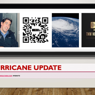
DISTURBANCE NOW CROSSING SOUTH FLORIDA… ...FLOODING RAINS OCCURRING ACROSS PORTIONS OF SOUTH FLORIDA...

DISTURBANCE NOW CROSSING SOUTH FLORIDA… ...FLOODING RAINS OCCURRING ACROSS PORTIONS OF SOUTH FLORIDA...

..DISTURBANCE NOW CROSSING SOUTH FLORIDA…

...FLOODING RAINS OCCURRING ACROSS PORTIONS OF SOUTH FLORIDA...

At 1100 AM EDT (1500 UTC), the disturbance IS ABOUT 35 MILES (60 km) northeast of Naples, Florida. The system is moving toward the northeast near 18 mph (30 km/h), and this general motion is expected to continue through tonight. A turn toward the east-northeast with an additional increase in forward speed is expected on Sunday, followed by a turn toward the east Monday night. On the forecast track, the disturbance is expected to move across southern or central Florida today, over the southwestern Atlantic north of the Bahamas tonight, and near or to the north of Bermuda on Monday.

Maximum sustained winds are near 40 mph (65 km/h) with higher gusts. The disturbance is expected to become a tropical storm off the east coast of Florida by tonight, and some strengthening is forecast tonight through Monday as the system moves farther away from Florida over the western Atlantic. It has a high (90 percent) chance of formation during the next 48 hours and during the next five days.

Tropical-storm-force winds extend outward up to 210 miles (335 km) to the east of the center. Over the past few hours, a weather station at Fowey Rocks near Miami, Florida reported sustained winds of 46 mph (74 km/h) and a wind gust of 56 mph (91 km/h) at an elevation of 144 ft (44 m).

RAINFALL: Heavy rainfall will continue to affect portions of South Florida and the Keys through this morning, beginning to diminish this afternoon. Heavy rainfall will continue across the northwestern Bahamas through today. The following storm totals are expected:

South Florida: Storm total of 6 to 10 inches with isolated maxima of 15 inches. Considerable flash and urban flooding is expected.

Florida Keys: Storm total of 4 to 8 inches with isolated maxima of 10 inches. This rain may produce flash and urban flooding.

Northwestern Bahamas: Storm total of 4 to 8 inches with maxima of 12 inches. This rain may produce flash and urban flooding.

WIND: Tropical storm conditions are expected in the warning area in Florida today, especially in squalls, and in the northwestern Bahamas by this afternoon.

STORM SURGE: Storm surge could raise water levels by as much 1- 3 ft above normal tide levels in the extreme northwestern Bahamas.

Surge-related flooding depends on the relative timing of the surge and the tidal cycle, and can vary greatly over short distances. For information specific to your area, please see products issued by your local National Weather Service forecast office.

TORNADOES: A couple tornadoes are possible over the southern Florida Peninsula and Upper Keys through early afternoon.

Next complete advisory at 500 PM EDT.

Det här avsnittet är hämtat från ett öppet RSS-flöde och publiceras inte av Podme. Det kan innehålla reklam.

Avsnitt(29)

Atlantic tropical development on the horizon next week

Atlantic tropical development on the horizon next week

Atlantic tropical development on the horizon next week

16 Juni 20232min

AIR FORCE HURRICANE HUNTERS INDICATE DEPRESSION HAS STRENGTHENED INTO TROPICAL STORM ARLENE... At 100 PM CDT (1800 UTC), the center of Tropical Storm Arlene was located about 340 miles NNW of the west

AIR FORCE HURRICANE HUNTERS INDICATE DEPRESSION HAS STRENGTHENED INTO TROPICAL STORM ARLENE... At 100 PM CDT (1800 UTC), the center of Tropical Storm Arlene was located about 340 miles NNW of the west

AIR FORCE HURRICANE HUNTERS INDICATE DEPRESSION HAS STRENGTHENEDINTO TROPICAL STORM ARLENE...At 100 PM CDT (1800 UTC), the center of Tropical Storm Arlene was located about 340 miles NNW of the wester...

2 Juni 20234min

Update on the area of low pressure over the northeastern Gulf of Mexico: Recent satellite wind data, along with buoy and ship observations indicate the area of low pressure over the northeastern Gulf

Update on the area of low pressure over the northeastern Gulf of Mexico: Recent satellite wind data, along with buoy and ship observations indicate the area of low pressure over the northeastern Gulf

Update on the area of low pressure over the northeastern Gulf of Mexico:Recent satellite wind data, along with buoy and ship observations indicate the area of low pressure over the northeastern Gulf o...

1 Juni 20233min

oday, in the Northeastern Gulf of Mexico, showers and thunderstorms associated with an area of low pressure over the northeastern Gulf of Mexico have increased and become better organized during the o

oday, in the Northeastern Gulf of Mexico, showers and thunderstorms associated with an area of low pressure over the northeastern Gulf of Mexico have increased and become better organized during the o

oday, in the Northeastern Gulf of Mexico, showers and thunderstorms associated with an area of low pressure over the northeastern Gulf of Mexico have increased and become better organized during the o...

1 Juni 20231min

Trevor Force season 2 of the hurricane update

Trevor Force season 2 of the hurricane update

Promo Force season of the Hurricane update,show update will officially start on June 1 2023 every hour for active Hurricane development. Every day from now on curve Hurricane development between 8 A...

24 Maj 202355s

..DANIELLE BECOMES THE FIRST ATLANTIC HURRICANE OF THE SEASON...

..DANIELLE BECOMES THE FIRST ATLANTIC HURRICANE OF THE SEASON...

..DANIELLE BECOMES THE FIRST ATLANTIC HURRICANE OF THE SEASON... At 300 PM GMT (1500 UTC), the center of Hurricane Danielle was about 885 miles (1425 km) west of the Azores (near latitude 37.9 North, ...

2 Sep 20223min

Showers and thunderstorms associated with an area of low pressure located about 300 miles south of the southern end of the Baja California Peninsula has become a little better organized overnight. Env

Showers and thunderstorms associated with an area of low pressure located about 300 miles south of the southern end of the Baja California Peninsula has become a little better organized overnight. Env

To the Eastern North Pacific: Showers and thunderstorms associated with an area of low pressure located about 300 miles south of the southern end of the Baja California Peninsula has become a little b...

1 Sep 20223min

 Hurricane DARBY RAPIDLY INTENSIFIES...

Hurricane DARBY RAPIDLY INTENSIFIES...

.DARBY RAPIDLY INTENSIFIES... At 1200 AM HST (1000 UTC), the center of Hurricane Darby was located near latitude 14.5 North, and longitude 122.2 West. Darby is moving toward the west near 16 mph (26 k...

11 Juli 20223min

Populärt inom Politik & nyheter

aftonbladet-krim
svenska-fall
p3-krim
fordomspodden
rss-krimstad
aftonbladet-daily
flashback-forever
rss-vad-fan-hande
en-runda-till
rss-sanning-konsekvens
politiken
svd-ledarredaktionen
rss-krimreportrarna
rss-flodet
omni-podd
motiv
rss-frandfors-horna
kungligt
rss-utopia-2
dagens-eko